 vesseltracker.com
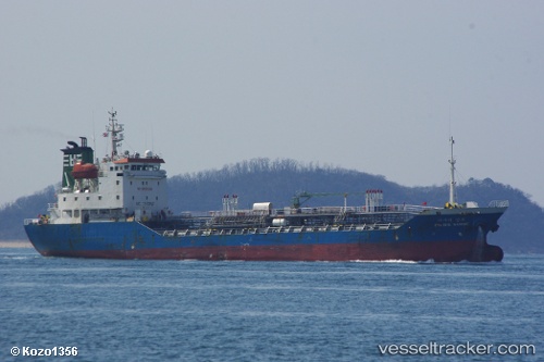
Vessel Pacific Sambu IMO: 9268306, MMSI: 441312000 Chemical Oil Products Tanker
UTC, 35.41915, 129.37538, course: 347, speed: 9.6
UTC, 35.44102, 129.37833, course: 22, speed: 0.1
2026-01-16 17:53:57 UTC, 35.44102, 129.37833, course: 22, speed: 0.1
Live AIS position:
UTC. Near ONSAN),
updated 2026-01-16 17:53:57 UTC.
Find the position of the vessel Pacific Sambu on the map. The latter are known coordinates and path.
marine traffic ship tracker show on live map
The current position of vessel Pacific Sambu is 35.44102 lat / 129.37833 lng. Updated: 2026-01-16 17:53:57 UTCCurrently sailing under the flag of Korea
Details:
Last coordinates of the vessel:
UTC, 35.39557, 129.37843, course: 357, speed: 12.5UTC, 35.41915, 129.37538, course: 347, speed: 9.6
UTC, 35.44102, 129.37833, course: 22, speed: 0.1
2026-01-16 17:53:57 UTC, 35.44102, 129.37833, course: 22, speed: 0.1