 vesseltracker.com
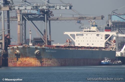
Vessel Berge Kinabalu IMO: 9271391, MMSI: 235101105 Ore Carrier
UTC, 9.59590, -13.90295, course: 214, speed: 0
UTC, 9.59565, -13.90288, course: 223, speed: 0
2026-01-18 06:53:53 UTC, 9.59553, -13.90278, course: 221, speed: 0
Live AIS position:
UTC. 12 nm NW of Conakry),
updated 2026-01-18 06:53:53 UTC.
Find the position of the vessel Berge Kinabalu on the map. The latter are known coordinates and path.
marine traffic ship tracker show on live map
The current position of vessel Berge Kinabalu is 9.59553 lat / -13.90278 lng. Updated: 2026-01-18 06:53:53 UTCDetails:
Last coordinates of the vessel:
UTC, 9.59562, -13.90257, course: 223, speed: 0UTC, 9.59590, -13.90295, course: 214, speed: 0
UTC, 9.59565, -13.90288, course: 223, speed: 0
2026-01-18 06:53:53 UTC, 9.59553, -13.90278, course: 221, speed: 0