 vesseltracker.com
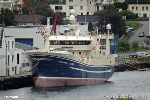
Find the position of the vessel GUNNAR on the map. The latter are known coordinates and path.
marine traffic ship tracker show on live map
The current position of vessel GUNNAR is 44.00345 lat / 145.84074 lng. Updated: 2025-10-08 12:29:18 UTCCurrently sailing under the flag of Russia
GUNNAR built in 2003 year
Deadweight:
2446 tDetails:
Last coordinates of the vessel:
UTC, 44.00427, 145.84064, course: 283, speed: 0.2UTC, 44.00427, 145.84064, course: 283, speed: 0.2
UTC, 44.00427, 145.84064, course: 283, speed: 0.2
2025-10-08 12:29:18 UTC, 44.00345, 145.84074, course: 304, speed: 0.1
The ship also appears on the maps:
- Ost-14
- Ostrovnoy
- Район - 6104
- Район - 6104.1
- ЮК
- ЮК район
- ЮК промысловый район
- ЮК промысловая зона - 1
- ЮК промысловый район -2
- ЮКР пелагика
- ЮК промысловая зона - 3
- ЮК промысловая зона - 4
- Южные Курилы - 5
- Южные Курилы - 6
- Южные Курилы - 1
- Южные Курилы - 1
- Южные Курилы - 2
- Южные Курилы - 3
- Суда пелагической путины Курильские острова