 vesseltracker.com
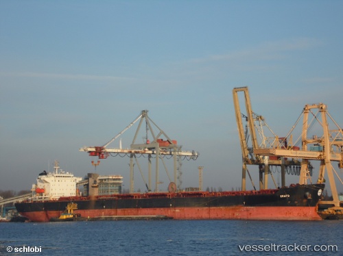
Vessel Kamares IMO: 9283631, MMSI: 370253000 Bulk Carrier
UTC, -3.94005, 115.72945, course: 238, speed: 0.2
UTC, -3.94000, 115.72955, course: 243, speed: 0
2026-01-16 05:23:44 UTC, -3.93951, 115.72919, course: 227, speed: 0
Live AIS position:
UTC. 13 nm SE of Bunati),
updated 2026-01-16 05:23:44 UTC.
Find the position of the vessel Kamares on the map. The latter are known coordinates and path.
marine traffic ship tracker show on live map
The current position of vessel Kamares is -3.93951 lat / 115.72919 lng. Updated: 2026-01-16 05:23:44 UTCCurrently sailing under the flag of Panama
Kamares built in 2004 year
Deadweight:
74444 tDetails:
Last coordinates of the vessel:
UTC, -3.93984, 115.72947, course: 240, speed: 0UTC, -3.94005, 115.72945, course: 238, speed: 0.2
UTC, -3.94000, 115.72955, course: 243, speed: 0
2026-01-16 05:23:44 UTC, -3.93951, 115.72919, course: 227, speed: 0