 vesseltracker.com
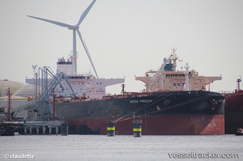
Vessel Nordic Freedom IMO: 9288887, MMSI: 311817000 Crude Oil Tanker
UTC, 21.98174, 61.86670, course: 33, speed: 0.5
UTC, 22.00210, 61.88200, course: 333, speed: 0.7
2026-01-20 04:55:37 UTC, 22.01068, 61.88784, course: 338, speed: 0.9
Live AIS position:
UTC. 135 nm E of SUR),
updated 2026-01-20 04:55:37 UTC.
Find the position of the vessel Nordic Freedom on the map. The latter are known coordinates and path.
marine traffic ship tracker show on live map
The current position of vessel Nordic Freedom is 22.01068 lat / 61.88784 lng. Updated: 2026-01-20 04:55:37 UTCDetails:
Last coordinates of the vessel:
UTC, 21.96793, 61.85055, course: 65, speed: 0.3UTC, 21.98174, 61.86670, course: 33, speed: 0.5
UTC, 22.00210, 61.88200, course: 333, speed: 0.7
2026-01-20 04:55:37 UTC, 22.01068, 61.88784, course: 338, speed: 0.9