 vesseltracker.com
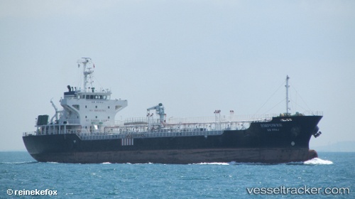
Vessel EMPOWER IMO: 9290220, MMSI: 533132192 Oil Products Tanker
UTC, 1.27728, 103.59217, course: 65, speed: 0
UTC, 1.27709, 103.59233, course: 44, speed: 0
2026-01-16 16:19:14 UTC, 1.27709, 103.59235, course: 49, speed: 0
Live AIS position:
UTC. Near Tuas),
updated 2026-01-16 16:19:14 UTC.
Find the position of the vessel EMPOWER on the map. The latter are known coordinates and path.
marine traffic ship tracker show on live map
The current position of vessel EMPOWER is 1.27709 lat / 103.59235 lng. Updated: 2026-01-16 16:19:14 UTCCurrently sailing under the flag of Malaysia
EMPOWER built in 2003 year
Deadweight:
7820 tDetails:
Last coordinates of the vessel:
UTC, 1.27731, 103.59217, course: 62, speed: 0UTC, 1.27728, 103.59217, course: 65, speed: 0
UTC, 1.27709, 103.59233, course: 44, speed: 0
2026-01-16 16:19:14 UTC, 1.27709, 103.59235, course: 49, speed: 0