 vesseltracker.com
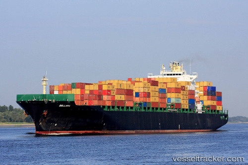
Vessel Bellavia IMO: 9290440, MMSI: 636092778 Container Ship
UTC, 48.39830, -123.21085, course: 46, speed: 15.2
UTC, 48.85354, -123.03786, course: 325, speed: 16.4
2026-01-16 17:46:10 UTC, 48.89990, -123.08827, course: 316, speed: 16.9
Live AIS position:
UTC. Near Point Roberts),
updated 2026-01-16 17:46:10 UTC.
Find the position of the vessel Bellavia on the map. The latter are known coordinates and path.
marine traffic ship tracker show on live map
The current position of vessel Bellavia is 48.89990 lat / -123.08827 lng. Updated: 2026-01-16 17:46:10 UTCCurrently sailing under the flag of Liberia
Bellavia built in 2005 year
Deadweight:
66478 tDetails:
Last coordinates of the vessel:
UTC, 48.25963, -123.43977, course: 18, speed: 15.2UTC, 48.39830, -123.21085, course: 46, speed: 15.2
UTC, 48.85354, -123.03786, course: 325, speed: 16.4
2026-01-16 17:46:10 UTC, 48.89990, -123.08827, course: 316, speed: 16.9