 vesseltracker.com
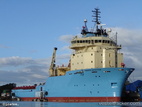
Find the position of the vessel Maersk Detector on the map. The latter are known coordinates and path.
marine traffic ship tracker show on live map
The current position of vessel Maersk Detector is 48.6521 lat / -123.45 lng. Updated: 2024-11-19 13:58:09 UTCCurrently sailing under the flag of Canada
Maersk Detector built in 2006 year
Port of registry:
St. John's (capital and largest city of the province of Newfoundland and Labrador, Canada)Deadweight:
4027 tGross tonnage:
5470Service entry:
2006-01-01T00:00:00ZManufacturer:
Asenav (Chilean shipbuilding company)
Details:
Last coordinates of the vessel:
2024-11-19 13:58:09 UTC, 48.6521, -123.45, course: 72, speed: 4.8