 vesseltracker.com
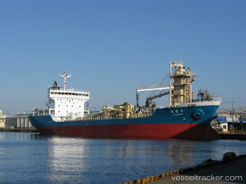
Vessel Aobamaru IMO: 9300180, MMSI: 431700585 Cement Carrier
UTC, 35.90879, 135.70367, course: 29, speed: 10
UTC, 35.91261, 135.70596, course: 31, speed: 10.2
2026-01-17 16:19:07 UTC, 35.95688, 135.73428, course: 30, speed: 10
Live AIS position:
UTC. 21 nm W of Echizen),
updated 2026-01-17 16:19:07 UTC.
Find the position of the vessel Aobamaru on the map. The latter are known coordinates and path.
marine traffic ship tracker show on live map
The current position of vessel Aobamaru is 35.95688 lat / 135.73428 lng. Updated: 2026-01-17 16:19:07 UTCCurrently sailing under the flag of Japan
Aobamaru built in 2003 year
Deadweight:
7269 tDetails:
Last coordinates of the vessel:
UTC, 35.77242, 135.59981, course: 48, speed: 10UTC, 35.90879, 135.70367, course: 29, speed: 10
UTC, 35.91261, 135.70596, course: 31, speed: 10.2
2026-01-17 16:19:07 UTC, 35.95688, 135.73428, course: 30, speed: 10