 vesseltracker.com
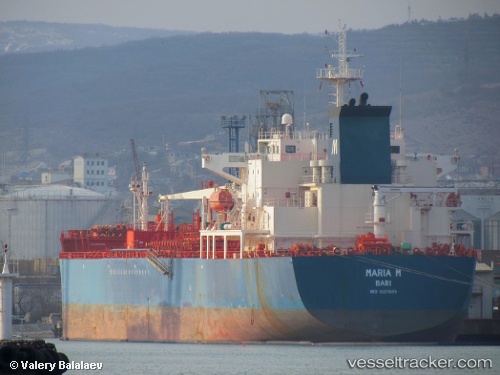
Vessel Maria M IMO: 9301885, MMSI: 247182500 Chemical Oil Products Tanker
UTC, 38.28802, 10.57632, course: 127, speed: 11.9
UTC, 38.28802, 10.57632, course: 127, speed: 11.9
2026-01-17 12:42:57 UTC, 37.93387, 11.20953, course: 129, speed: 13.1
Live AIS position:
UTC. 41 nm W of MARETTIMO),
updated 2026-01-17 12:42:57 UTC.
Find the position of the vessel Maria M on the map. The latter are known coordinates and path.
marine traffic ship tracker show on live map
The current position of vessel Maria M is 37.93387 lat / 11.20953 lng. Updated: 2026-01-17 12:42:57 UTCCurrently sailing under the flag of Italy
Maria M built in 2006 year
Deadweight:
40057 tDetails:
Last coordinates of the vessel:
UTC, 38.34847, 10.47398, course: 125, speed: 12.1UTC, 38.28802, 10.57632, course: 127, speed: 11.9
UTC, 38.28802, 10.57632, course: 127, speed: 11.9
2026-01-17 12:42:57 UTC, 37.93387, 11.20953, course: 129, speed: 13.1