 vesseltracker.com
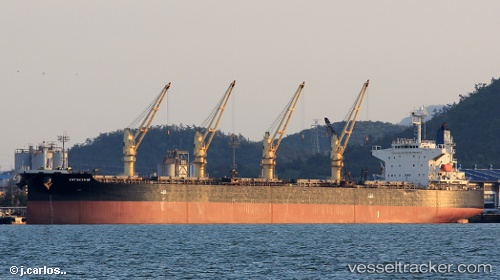
Vessel Antakya M IMO: 9302803, MMSI: 354214000 Bulk Carrier
UTC, 44.98366, 30.09072, course: 21, speed: 0
UTC, 44.98382, 30.09035, course: 37, speed: 0.2
2026-01-16 00:25:06 UTC, 44.98382, 30.09055, course: 22, speed: 0.2
Live AIS position:
UTC. 21 nm SE of Sulina (Port et Zone Franche)),
updated 2026-01-16 00:25:06 UTC.
Find the position of the vessel Antakya M on the map. The latter are known coordinates and path.
marine traffic ship tracker show on live map
The current position of vessel Antakya M is 44.98382 lat / 30.09055 lng. Updated: 2026-01-16 00:25:06 UTCDetails:
Last coordinates of the vessel:
UTC, 44.98397, 30.09008, course: 48, speed: 0.3UTC, 44.98366, 30.09072, course: 21, speed: 0
UTC, 44.98382, 30.09035, course: 37, speed: 0.2
2026-01-16 00:25:06 UTC, 44.98382, 30.09055, course: 22, speed: 0.2