 vesseltracker.com
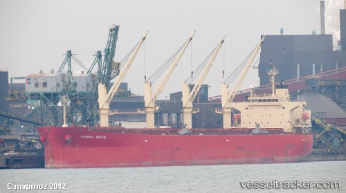
Vessel DHRAMA LAUTAN RUBY IMO: 9304095, MMSI: 525103003 Bulk Carrier
UTC, 1.09581, 104.17415, course: -1, speed: 0.5
UTC, 1.09581, 104.17415, course: -1, speed: 0.5
2026-01-14 07:54:57 UTC, 1.09581, 104.17415, course: -1, speed: 0.5
Live AIS position:
UTC. Near KABIL),
updated 2026-01-14 07:54:57 UTC.
Find the position of the vessel DHRAMA LAUTAN RUBY on the map. The latter are known coordinates and path.
marine traffic ship tracker show on live map
The current position of vessel DHRAMA LAUTAN RUBY is 1.09581 lat / 104.17415 lng. Updated: 2026-01-14 07:54:57 UTCCurrently sailing under the flag of Indonesia
DHRAMA LAUTAN RUBY built in 2007 year
Deadweight:
55309 tDetails:
Last coordinates of the vessel:
UTC, 1.09581, 104.17415, course: -1, speed: 0.5UTC, 1.09581, 104.17415, course: -1, speed: 0.5
UTC, 1.09581, 104.17415, course: -1, speed: 0.5
2026-01-14 07:54:57 UTC, 1.09581, 104.17415, course: -1, speed: 0.5