 vesseltracker.com
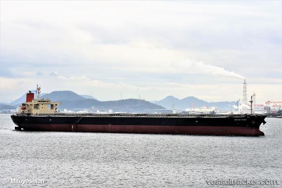
Vessel SEMA M IMO: 9304150, MMSI: 636021876 Bulk Carrier
UTC, 39.00703, 121.68622, course: 56, speed: 0.2
UTC, 39.00605, 121.68705, course: 56, speed: 0
2026-01-16 11:22:41 UTC, 39.00568, 121.68567, course: 56, speed: 0
Live AIS position:
UTC. Near Dalian),
updated 2026-01-16 11:22:41 UTC.
Find the position of the vessel SEMA M on the map. The latter are known coordinates and path.
marine traffic ship tracker show on live map
The current position of vessel SEMA M is 39.00568 lat / 121.68567 lng. Updated: 2026-01-16 11:22:41 UTCCurrently sailing under the flag of Liberia
SEMA M built in 2007 year
Deadweight:
106552 tDetails:
Last coordinates of the vessel:
UTC, 39.00608, 121.68608, course: 56, speed: 0.1UTC, 39.00703, 121.68622, course: 56, speed: 0.2
UTC, 39.00605, 121.68705, course: 56, speed: 0
2026-01-16 11:22:41 UTC, 39.00568, 121.68567, course: 56, speed: 0