 vesseltracker.com
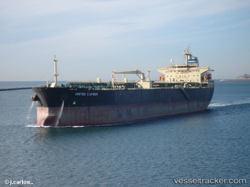
Vessel Lr1 Carrier IMO: 9307102, MMSI: 636018862 Crude Oil Tanker
UTC, 21.88985, -111.54858, course: 320, speed: 12.6
UTC, 22.01833, -111.66500, course: -1, speed: 12
2026-01-19 21:27:32 UTC, 22.08631, -111.72723, course: 321, speed: 12.4
Live AIS position:
UTC. 112 nm SW of Los Cabos),
updated 2026-01-19 21:27:32 UTC.
Find the position of the vessel Lr1 Carrier on the map. The latter are known coordinates and path.
marine traffic ship tracker show on live map
The current position of vessel Lr1 Carrier is 22.08631 lat / -111.72723 lng. Updated: 2026-01-19 21:27:32 UTCCurrently sailing under the flag of Liberia
Lr1 Carrier built in 2007 year
Deadweight:
73675 tDetails:
Last coordinates of the vessel:
UTC, 21.47040, -111.17253, course: 320, speed: 12.1UTC, 21.88985, -111.54858, course: 320, speed: 12.6
UTC, 22.01833, -111.66500, course: -1, speed: 12
2026-01-19 21:27:32 UTC, 22.08631, -111.72723, course: 321, speed: 12.4