 vesseltracker.com
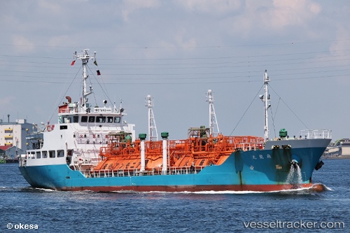
Vessel Senryumaru IMO: 9309564, MMSI: 431401993 Lpg Tanker
UTC, 32.97566, 131.91280, course: 22, speed: 0
UTC, 32.97562, 131.91287, course: 22, speed: 0
2026-01-16 13:19:06 UTC, 32.97563, 131.91287, course: 23, speed: 0.1
Live AIS position:
UTC. Near SAEKI),
updated 2026-01-16 13:19:06 UTC.
Find the position of the vessel Senryumaru on the map. The latter are known coordinates and path.
marine traffic ship tracker show on live map
The current position of vessel Senryumaru is 32.97563 lat / 131.91287 lng. Updated: 2026-01-16 13:19:06 UTCCurrently sailing under the flag of Japan
Details:
Last coordinates of the vessel:
UTC, 32.97566, 131.91280, course: 22, speed: 0UTC, 32.97566, 131.91280, course: 22, speed: 0
UTC, 32.97562, 131.91287, course: 22, speed: 0
2026-01-16 13:19:06 UTC, 32.97563, 131.91287, course: 23, speed: 0.1