.
vessel '538009382' IMO: 9310135, vesseltracker.com
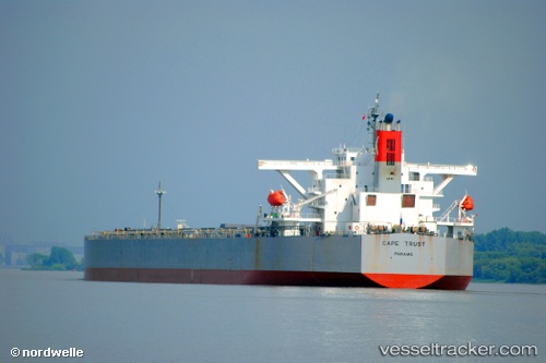
Vessel '538009382' IMO: 9310135, MMSI: 538009382

callsign:
size: x

Live AIS position: UTC. 167 nm SW of Atafu), updated 2025-12-13 10:35:50 UTC.

Find the position of the vessel '538009382' on the map. The latter are known coordinates and path.

marine traffic ship tracker show on live map

The current position of vessel '538009382' is -9.79106 lat / -175.02782 lng. Updated: 2025-12-13 10:35:50 UTC
Details:


Last coordinates of the vessel:
2025-12-13 10:35:50 UTC, -9.79106, -175.02782, course: -1, speed: 54.3


Most frequent ports a vessels calls at '538009382' (538009382):

Whyalla, traffic: 4
Selat Lombok, traffic: 3
Singapore, traffic: 3
Dampier, traffic: 3
Sambu, traffic: 3
Richards Bay, traffic: 2
Selat Sunda, traffic: 1
Vancouver, traffic: 1
Victoria, traffic: 1
Hong Kong, traffic: 1
Lianyungang, traffic: 1
Wu-Sung, traffic: 1
Port Walcot, traffic: 1
Wusong, traffic: 1
Samson Point, traffic: 1

Link to the map:


Find another ship

'538009382' (538009382) last ports (portcalls and passsages)

Richards Bay | 2023-12-28 06:22:00
Richards Bay | 2023-12-19 21:17:15
Victoria | 2023-01-01 02:46:09
Vancouver | 2022-12-28 02:12:44
Lianyungang | 2022-11-04 06:01:37
Whyalla | 2022-09-30 19:52:08
Whyalla | 2022-09-26 19:44:38
Selat Lombok | 2022-09-16 05:06:35
Dampier | 2022-08-14 01:17:57
Singapore | 2022-08-01 01:04:08
Hong Kong | 2022-07-24 22:38:28
Selat Sunda | 2022-06-27 10:10:38
Whyalla | 2022-06-09 08:01:28
Whyalla | 2022-06-05 07:38:29
Wusong | 2022-05-13 14:00:38
Samson Point | 2022-04-18 12:56:11
Selat Lombok | 2022-04-10 00:21:56
Dampier | 2022-02-20 03:07:29
Sambu | 2022-01-10 21:35:29
Singapore | 2022-01-10 20:35:59