 vesseltracker.com
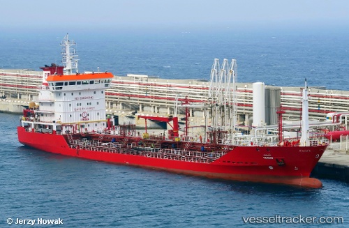
Vessel Tingis IMO: 9310197, MMSI: 242924000 Chemical Oil Products Tanker
UTC, 30.42118, -9.66343, course: 312, speed: 0
UTC, 30.42123, -9.66332, course: 308, speed: 0
2026-01-17 19:48:12 UTC, 30.42128, -9.66332, course: 315, speed: 0.1
Live AIS position:
UTC. Near Anza),
updated 2026-01-17 19:48:12 UTC.
Find the position of the vessel Tingis on the map. The latter are known coordinates and path.
marine traffic ship tracker show on live map
The current position of vessel Tingis is 30.42128 lat / -9.66332 lng. Updated: 2026-01-17 19:48:12 UTCCurrently sailing under the flag of Morocco
Tingis built in 2005 year
Deadweight:
6937 tDetails:
Last coordinates of the vessel:
UTC, 30.42133, -9.66330, course: 305, speed: 0UTC, 30.42118, -9.66343, course: 312, speed: 0
UTC, 30.42123, -9.66332, course: 308, speed: 0
2026-01-17 19:48:12 UTC, 30.42128, -9.66332, course: 315, speed: 0.1