 vesseltracker.com
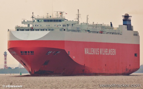
Vessel Talia IMO: 9311854, MMSI: 308599000 Vehicles Carrier
UTC, 30.08667, 155.25166, course: -1, speed: 16
UTC, 29.96583, 155.63315, course: 112, speed: 16
2026-01-18 14:05:40 UTC, 29.85167, 155.97501, course: -1, speed: 16
Live AIS position:
UTC. Open sea (no nearby ports in database)),
updated 2026-01-18 14:05:40 UTC.
Find the position of the vessel Talia on the map. The latter are known coordinates and path.
marine traffic ship tracker show on live map
The current position of vessel Talia is 29.85167 lat / 155.97501 lng. Updated: 2026-01-18 14:05:40 UTCCurrently sailing under the flag of Bahamas
Talia built in 2006 year
Deadweight:
21021 tDetails:
Last coordinates of the vessel:
UTC, 30.20333, 154.88834, course: -1, speed: 17UTC, 30.08667, 155.25166, course: -1, speed: 16
UTC, 29.96583, 155.63315, course: 112, speed: 16
2026-01-18 14:05:40 UTC, 29.85167, 155.97501, course: -1, speed: 16