 vesseltracker.com
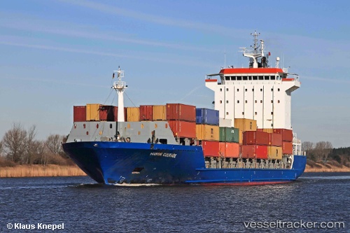
Vessel Elke IMO: 9318773, MMSI: 210731000 Container Ship
UTC, 59.49097, 24.96850, course: 132, speed: 0
UTC, 59.49094, 24.96843, course: 131, speed: 0
2026-01-17 13:28:04 UTC, 59.50421, 24.96399, course: 354, speed: 10.8
Live AIS position:
UTC. Near Muuga),
updated 2026-01-17 13:28:04 UTC.
Find the position of the vessel Elke on the map. The latter are known coordinates and path.
marine traffic ship tracker show on live map
The current position of vessel Elke is 59.50421 lat / 24.96399 lng. Updated: 2026-01-17 13:28:04 UTCCurrently sailing under the flag of Cyprus
Elke built in 2005 year
Deadweight:
11023 tDetails:
Last coordinates of the vessel:
UTC, 59.49097, 24.96845, course: 132, speed: 0.1UTC, 59.49097, 24.96850, course: 132, speed: 0
UTC, 59.49094, 24.96843, course: 131, speed: 0
2026-01-17 13:28:04 UTC, 59.50421, 24.96399, course: 354, speed: 10.8