 vesseltracker.com
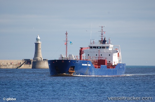
Vessel Solway Fisher IMO: 9320491, MMSI: 308665000 Oil Products Tanker
UTC, 53.61228, -0.09508, course: 119, speed: 8.2
UTC, 53.58695, 0.02078, course: 106, speed: 9.3
2026-01-18 16:50:53 UTC, 53.54150, 0.19789, course: 86, speed: 8.3
Live AIS position:
UTC. Near Tetney Terminal),
updated 2026-01-18 16:50:53 UTC.
Find the position of the vessel Solway Fisher on the map. The latter are known coordinates and path.
marine traffic ship tracker show on live map
The current position of vessel Solway Fisher is 53.54150 lat / 0.19789 lng. Updated: 2026-01-18 16:50:53 UTCCurrently sailing under the flag of Bahamas
Solway Fisher built in 2006 year
Deadweight:
5422 tDetails:
Last coordinates of the vessel:
UTC, 53.62882, -0.16805, course: 114, speed: 0UTC, 53.61228, -0.09508, course: 119, speed: 8.2
UTC, 53.58695, 0.02078, course: 106, speed: 9.3
2026-01-18 16:50:53 UTC, 53.54150, 0.19789, course: 86, speed: 8.3