 vesseltracker.com
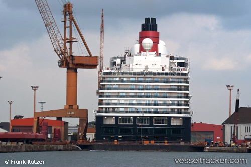
Vessel Queen Victoria IMO: 9320556, MMSI: 310624000 Cruise Ship
UTC, 12.05166, -61.75667, course: -1, speed: 0
UTC, 12.05166, -61.75667, course: -1, speed: 0
2026-01-17 15:35:14 UTC, 12.05166, -61.75667, course: -1, speed: 0
Live AIS position:
UTC. Near ST GEORGES),
updated 2026-01-17 15:35:14 UTC.
Find the position of the vessel Queen Victoria on the map. The latter are known coordinates and path.
marine traffic ship tracker show on live map
The current position of vessel Queen Victoria is 12.05166 lat / -61.75667 lng. Updated: 2026-01-17 15:35:14 UTCCurrently sailing under the flag of Bermuda
Queen Victoria built in 2007 year
Deadweight:
7685 tDetails:
Last coordinates of the vessel:
UTC, 12.05168, -61.75633, course: 124, speed: 0UTC, 12.05166, -61.75667, course: -1, speed: 0
UTC, 12.05166, -61.75667, course: -1, speed: 0
2026-01-17 15:35:14 UTC, 12.05166, -61.75667, course: -1, speed: 0