 vesseltracker.com
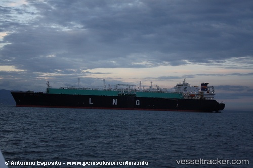
Vessel Seri Angkasa IMO: 9321665, MMSI: 533957000 Lng Tanker
UTC, 2.48900, 124.87504, course: 274, speed: 14.5
UTC, 2.48900, 124.87504, course: 274, speed: 14.5
2026-01-18 19:06:45 UTC, 2.08273, 122.35242, course: 262, speed: 16.1
Live AIS position:
UTC. 78 nm N of ANGGREK),
updated 2026-01-18 19:06:45 UTC.
Find the position of the vessel Seri Angkasa on the map. The latter are known coordinates and path.
marine traffic ship tracker show on live map
The current position of vessel Seri Angkasa is 2.08273 lat / 122.35242 lng. Updated: 2026-01-18 19:06:45 UTCCurrently sailing under the flag of Malaysia
Seri Angkasa built in 2006 year
Deadweight:
83407 tDetails:
Last coordinates of the vessel:
UTC, 2.48900, 124.87504, course: 274, speed: 14.5UTC, 2.48900, 124.87504, course: 274, speed: 14.5
UTC, 2.48900, 124.87504, course: 274, speed: 14.5
2026-01-18 19:06:45 UTC, 2.08273, 122.35242, course: 262, speed: 16.1