 vesseltracker.com
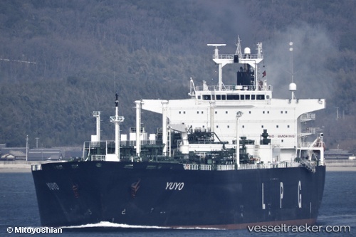
Vessel Yuyo IMO: 9322657, MMSI: 371230000 Lpg Tanker
UTC, 19.86845, -81.38412, course: 295, speed: 14.6
UTC, 19.97220, -81.61755, course: 295, speed: 14
2026-01-18 14:41:48 UTC, 19.97220, -81.61755, course: 295, speed: 14
Live AIS position:
UTC. 42 nm N of Georgetown, Grand Cayman),
updated 2026-01-18 14:41:48 UTC.
Find the position of the vessel Yuyo on the map. The latter are known coordinates and path.
marine traffic ship tracker show on live map
The current position of vessel Yuyo is 19.97220 lat / -81.61755 lng. Updated: 2026-01-18 14:41:48 UTCDetails:
Last coordinates of the vessel:
UTC, 19.72413, -81.04349, course: 294, speed: 13.4UTC, 19.86845, -81.38412, course: 295, speed: 14.6
UTC, 19.97220, -81.61755, course: 295, speed: 14
2026-01-18 14:41:48 UTC, 19.97220, -81.61755, course: 295, speed: 14