 vesseltracker.com
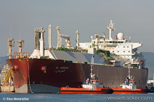
Vessel Al Areesh IMO: 9325697, MMSI: 311038000 Lng Tanker
UTC, -18.33208, 1.69580, course: 320, speed: 14.9
UTC, -17.99963, 1.40874, course: 320, speed: 14.9
2026-01-18 13:01:52 UTC, -17.78333, 1.22167, course: -1, speed: 14
Live AIS position:
UTC. Open sea, approx. 413 nm off the nearest listed port),
updated 2026-01-18 13:01:52 UTC.
Find the position of the vessel Al Areesh on the map. The latter are known coordinates and path.
marine traffic ship tracker show on live map
The current position of vessel Al Areesh is -17.78333 lat / 1.22167 lng. Updated: 2026-01-18 13:01:52 UTCDetails:
Last coordinates of the vessel:
UTC, -18.41912, 1.76782, course: 324, speed: 14.7UTC, -18.33208, 1.69580, course: 320, speed: 14.9
UTC, -17.99963, 1.40874, course: 320, speed: 14.9
2026-01-18 13:01:52 UTC, -17.78333, 1.22167, course: -1, speed: 14