 vesseltracker.com
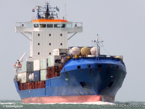
Vessel EDITH IMO: 9328625, MMSI: 255805906 Container Ship
UTC, 54.68360, 15.46593, course: 85, speed: 11.6
UTC, 54.73244, 16.06345, course: 82, speed: 11.9
2026-03-09 05:24:42 UTC, 54.78145, 16.60732, course: 83, speed: 11.4
Live Vessel EDITH Analytics (details, animations, etc.)
Live AIS position: UTC. 15 nm NW of Ustka), updated 2026-03-09 05:24:42 UTC.Find the position of the vessel EDITH on the map. The latter are known coordinates and path.
marine traffic ship tracker show on live map
The current position of vessel EDITH is 54.78145 lat / 16.60732 lng. Updated: 2026-03-09 05:24:42 UTCCurrently sailing under the flag of Portugal (MAR)
EDITH built in 2005 year
Deadweight:
9217 tDetails:
Last coordinates of the vessel:
UTC, 54.64044, 14.94136, course: -1, speed: 11.8UTC, 54.68360, 15.46593, course: 85, speed: 11.6
UTC, 54.73244, 16.06345, course: 82, speed: 11.9
2026-03-09 05:24:42 UTC, 54.78145, 16.60732, course: 83, speed: 11.4