vessel QI MING STAR IMO: 9331531, Bulk Carrier vesseltracker.com
Vessel QI MING STAR IMO: 9331531, Bulk Carrier
MMSI: 636020234 callsign: D5YG6 size: 50x300

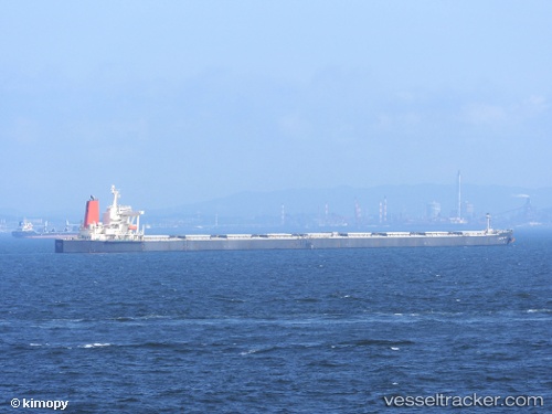
Find the position of the vessel QI MING STAR on the map. The latter are known coordinates and path.

marine traffic ship tracker show on live map

The current position of vessel QI MING STAR is -23.2334 lat / -44.022 lng. Updated: 2025-07-16 13:44:35 UTC

Currently sailing under the flag of Liberia

QI MING STAR built in 2005 year

Deadweight:
203212 t

Details:


Last coordinates of the vessel:
UTC, -23.2336, -44.0218, course: 73, speed: 0.1
UTC, -23.2335, -44.0219, course: 79, speed: 0
UTC, -23.2334, -44.0219, course: 82, speed: 0
2025-07-16 13:44:35 UTC, -23.2334, -44.022, course: 82, speed: 0.1


Most frequent ports a vessels calls at QI MING STAR (636020234):

Sambu, traffic: 5
Singapore, traffic: 5
Qingdao, traffic: 4
PENGERANG, traffic: 2
HUANGHUA, traffic: 2
Cape Of Good Hope, traffic: 2
Dagu Bar, traffic: 2
TANAH MERAH, traffic: 2
Dagu, traffic: 2
Ta-Ku, traffic: 2
BUKOM ISLAND, traffic: 1
PULAU SAMBU, traffic: 1
Taku Bar, traffic: 1

Link to the map:


Find another ship

QI_MING_STAR (636020234) last ports (portcalls and passsages)

PULAU SAMBU | 2025-06-09 17:03:01
TANAH MERAH | 2025-06-09 00:18:46
PENGERANG | 2025-06-08 22:07:53
TANAH MERAH | 2025-03-07 03:30:24
PENGERANG | 2025-03-07 02:04:04
HUANGHUA | 2025-02-24 02:02:10
HUANGHUA | 2025-02-19 12:56:06
Singapore | 2024-10-16 09:43:49
Qingdao | 2024-06-18 23:54:50
Dagu Bar | 2024-03-08 08:07:05
Ta-Ku | 2024-03-08 02:58:21
Ta-Ku | 2024-03-04 02:04:16
Dagu Bar | 2024-03-04 00:11:24
Taku Bar | 2024-03-03 22:59:54
Cape Of Good Hope | 2024-01-25 13:36:20
Singapore | 2023-12-04 08:07:28
Sambu | 2023-12-04 07:06:07
Qingdao | 2023-11-25 03:21:12
Qingdao | 2023-11-19 23:58:14
Qingdao | 2023-08-02 08:11:09
Cape Of Good Hope | 2023-05-20 00:10:48
Singapore | 2023-04-29 20:06:36
Singapore | 2023-01-20 23:57:16