 vesseltracker.com
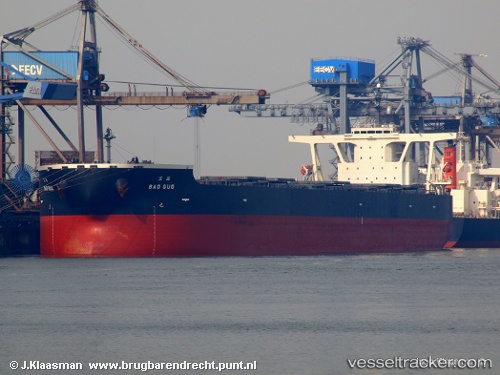
Vessel Bao Guo IMO: 9336969, MMSI: 370293000 Ore Carrier
UTC, 9.52236, -14.84247, course: 185, speed: 8.9
UTC, 9.25084, -14.85237, course: 187, speed: 9.5
2026-01-17 18:31:49 UTC, 9.22967, -14.85403, course: 187, speed: 9.5
Live AIS position:
UTC. 69 nm W of Conakry),
updated 2026-01-17 18:31:49 UTC.
Find the position of the vessel Bao Guo on the map. The latter are known coordinates and path.
marine traffic ship tracker show on live map
The current position of vessel Bao Guo is 9.22967 lat / -14.85403 lng. Updated: 2026-01-17 18:31:49 UTCDetails:
Last coordinates of the vessel:
UTC, 9.71288, -14.84327, course: 182, speed: 9UTC, 9.52236, -14.84247, course: 185, speed: 8.9
UTC, 9.25084, -14.85237, course: 187, speed: 9.5
2026-01-17 18:31:49 UTC, 9.22967, -14.85403, course: 187, speed: 9.5