 vesseltracker.com
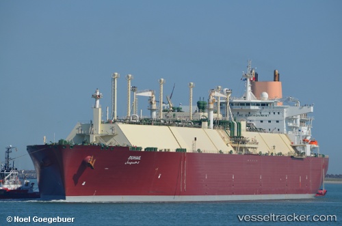
Vessel Duhail IMO: 9337975, MMSI: 309599000 Lng Tanker
UTC, 23.42199, 122.89418, course: 22, speed: 14.1
UTC, 23.54025, 122.95122, course: 22, speed: 13.5
2026-01-17 18:22:54 UTC, 23.91296, 123.12936, course: 25, speed: 14.3
Live AIS position:
UTC. 37 nm W of Hateruma),
updated 2026-01-17 18:22:54 UTC.
Find the position of the vessel Duhail on the map. The latter are known coordinates and path.
marine traffic ship tracker show on live map
The current position of vessel Duhail is 23.91296 lat / 123.12936 lng. Updated: 2026-01-17 18:22:54 UTCCurrently sailing under the flag of Bahamas
Duhail built in 2008 year
Deadweight:
121639 tDetails:
Last coordinates of the vessel:
UTC, 23.03765, 122.70813, course: 24, speed: 14.5UTC, 23.42199, 122.89418, course: 22, speed: 14.1
UTC, 23.54025, 122.95122, course: 22, speed: 13.5
2026-01-17 18:22:54 UTC, 23.91296, 123.12936, course: 25, speed: 14.3