 vesseltracker.com
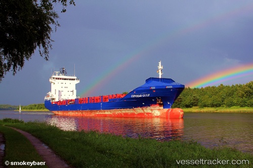
Vessel Conmar Gulf IMO: 9341964, MMSI: 255806177 Container Ship
UTC, -37.71422, -85.33097, course: 172, speed: 37.8
UTC, -37.71422, -85.33097, course: 172, speed: 37.8
2026-01-17 09:09:45 UTC, -37.71422, -85.33097, course: 172, speed: 37.8
Live AIS position:
UTC. 364 nm SW of Juan Fernández),
updated 2026-01-17 09:09:45 UTC.
Find the position of the vessel Conmar Gulf on the map. The latter are known coordinates and path.
marine traffic ship tracker show on live map
The current position of vessel Conmar Gulf is -37.71422 lat / -85.33097 lng. Updated: 2026-01-17 09:09:45 UTCCurrently sailing under the flag of Portugal
Conmar Gulf built in 2007 year
Deadweight:
8146 tDetails:
Last coordinates of the vessel:
UTC, -37.71422, -85.33097, course: 172, speed: 37.8UTC, -37.71422, -85.33097, course: 172, speed: 37.8
UTC, -37.71422, -85.33097, course: 172, speed: 37.8
2026-01-17 09:09:45 UTC, -37.71422, -85.33097, course: 172, speed: 37.8