 vesseltracker.com
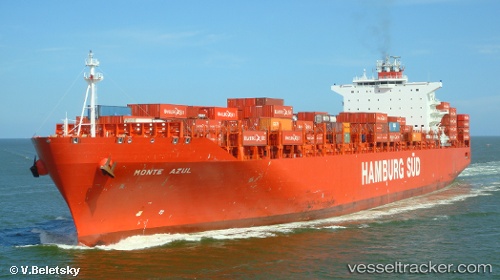
Vessel Monte Azul IMO: 9348053, MMSI: 563051700 Container Ship
UTC, 38.68900, -74.88832, course: 317, speed: 9.4
UTC, 38.75482, -74.96103, course: 280, speed: 4.9
2026-01-17 03:00:34 UTC, 38.93490, -75.10322, course: 337, speed: 14.5
Live AIS position:
UTC. Near Ocean View),
updated 2026-01-17 03:00:34 UTC.
Find the position of the vessel Monte Azul on the map. The latter are known coordinates and path.
marine traffic ship tracker show on live map
The current position of vessel Monte Azul is 38.93490 lat / -75.10322 lng. Updated: 2026-01-17 03:00:34 UTCDetails:
Last coordinates of the vessel:
UTC, 38.48943, -74.69510, course: 317, speed: 9.4UTC, 38.68900, -74.88832, course: 317, speed: 9.4
UTC, 38.75482, -74.96103, course: 280, speed: 4.9
2026-01-17 03:00:34 UTC, 38.93490, -75.10322, course: 337, speed: 14.5