 vesseltracker.com
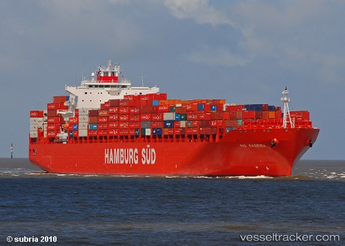
Vessel Rio Madeira IMO: 9348106, MMSI: 563051600 Container Ship
UTC, -9.32268, 132.94479, course: 103, speed: 16.7
UTC, -9.42555, 133.47433, course: 101, speed: 17
2026-01-18 13:29:41 UTC, -9.49347, 133.84595, course: 101, speed: 17
Live AIS position:
UTC. 137 nm NE of Raffles Bay),
updated 2026-01-18 13:29:41 UTC.
Find the position of the vessel Rio Madeira on the map. The latter are known coordinates and path.
marine traffic ship tracker show on live map
The current position of vessel Rio Madeira is -9.49347 lat / 133.84595 lng. Updated: 2026-01-18 13:29:41 UTCCurrently sailing under the flag of Singapore
Rio Madeira built in 2009 year
Deadweight:
80293 tDetails:
Last coordinates of the vessel:
UTC, -9.28150, 132.71248, course: 100, speed: 16.6UTC, -9.32268, 132.94479, course: 103, speed: 16.7
UTC, -9.42555, 133.47433, course: 101, speed: 17
2026-01-18 13:29:41 UTC, -9.49347, 133.84595, course: 101, speed: 17