 vesseltracker.com
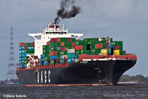
Vessel Al Manamah IMO: 9349538, MMSI: 636017668 Container Ship
Live AIS position:
UTC. 22 nm W of Feijo),
updated 2025-12-08 03:42:50 UTC.
Find the position of the vessel Al Manamah on the map. The latter are known coordinates and path.
marine traffic ship tracker show on live map
The current position of vessel Al Manamah is 38.07744 lat / -9.60120 lng. Updated: 2025-12-08 03:42:50 UTCCurrently sailing under the flag of Liberia
Al Manamah built in 2008 year
Deadweight:
85517 tDetails:
Last coordinates of the vessel:
2025-12-08 03:42:50 UTC, 38.07744, -9.60120, course: 161, speed: 10.2