 vesseltracker.com
Live AIS position:
51.96035° N, 6.23321° W UTC. 14 nm E of Bredevoort),
updated 2025-11-19 20:52:10 UTC.
Find the position of the vessel Victoria Seaways on the map. The latter are known coordinates and path.
marine traffic ship tracker show on live map
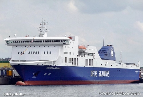
The current position of vessel Victoria Seaways is 51.96035 lat / -6.23321 lng. Updated: 2025-11-19 20:52:10 UTCCurrently sailing under the flag of Lithuania
Victoria Seaways built in 2009 year
Deadweight:
8500 tDetails:
Last coordinates of the vessel:
UTC, 50.95692, -6.00651, course: 351, speed: 21.1UTC, 51.17599, -6.06446, course: 354, speed: 21.4
UTC, 51.47737, -6.12888, course: 355, speed: 21.8
2025-11-19 20:52:10 UTC, 51.96035, -6.23321, course: 352, speed: 21.7