 vesseltracker.com
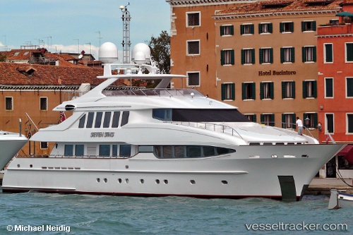
Vessel The Lady K IMO: 9350874, MMSI: 319425000 Service Ship
UTC, 8.63630, -83.17140, course: 208, speed: 0
UTC, 8.63630, -83.17140, course: 208, speed: 0
2026-01-18 03:46:03 UTC, 8.63630, -83.17140, course: 208, speed: 0
Live AIS position:
UTC. Near Golfito),
updated 2026-01-18 03:46:03 UTC.
Find the position of the vessel The Lady K on the map. The latter are known coordinates and path.
marine traffic ship tracker show on live map
The current position of vessel The Lady K is 8.63630 lat / -83.17140 lng. Updated: 2026-01-18 03:46:03 UTCCurrently sailing under the flag of Cayman Is
Details:
Last coordinates of the vessel:
UTC, 8.63630, -83.17140, course: 208, speed: 0UTC, 8.63630, -83.17140, course: 208, speed: 0
UTC, 8.63630, -83.17140, course: 208, speed: 0
2026-01-18 03:46:03 UTC, 8.63630, -83.17140, course: 208, speed: 0