 vesseltracker.com
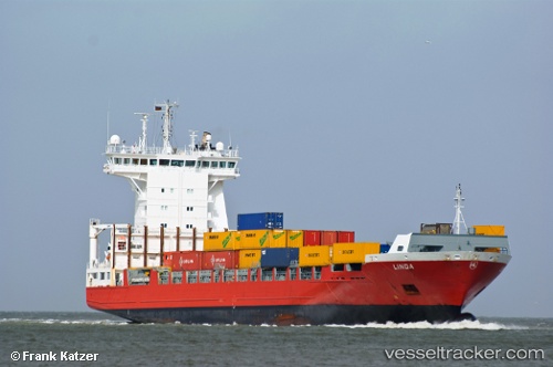
Vessel Linda IMO: 9354325, MMSI: 230984000 Container Ship
UTC, 51.42242, 3.50190, course: 258, speed: 16.1
UTC, 51.41535, 3.43995, course: 262, speed: 16.4
2026-01-17 21:43:27 UTC, 51.38465, 2.95150, course: 258, speed: 16.4
Live AIS position:
UTC. Near De Haan),
updated 2026-01-17 21:43:27 UTC.
Find the position of the vessel Linda on the map. The latter are known coordinates and path.
marine traffic ship tracker show on live map
The current position of vessel Linda is 51.38465 lat / 2.95150 lng. Updated: 2026-01-17 21:43:27 UTCCurrently sailing under the flag of Finland
Linda built in 2007 year
Deadweight:
11487 tDetails:
Last coordinates of the vessel:
UTC, 51.37422, 4.06460, course: 286, speed: 18.8UTC, 51.42242, 3.50190, course: 258, speed: 16.1
UTC, 51.41535, 3.43995, course: 262, speed: 16.4
2026-01-17 21:43:27 UTC, 51.38465, 2.95150, course: 258, speed: 16.4