 vesseltracker.com
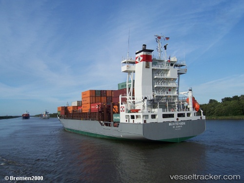
Vessel Buxtehude IMO: 9354399, MMSI: 304962000 Container Ship
UTC, 54.30687, 7.90332, course: 160, speed: 9
UTC, 54.23799, 7.93426, course: 159, speed: 9
2026-01-18 16:48:37 UTC, 54.08318, 7.95754, course: 172, speed: 9.3
Live AIS position:
UTC. Near Helgoland),
updated 2026-01-18 16:48:37 UTC.
Find the position of the vessel Buxtehude on the map. The latter are known coordinates and path.
marine traffic ship tracker show on live map
The current position of vessel Buxtehude is 54.08318 lat / 7.95754 lng. Updated: 2026-01-18 16:48:37 UTCCurrently sailing under the flag of Antigua Barbuda
Buxtehude built in 2006 year
Deadweight:
11431 tDetails:
Last coordinates of the vessel:
UTC, 54.46679, 7.83991, course: 161, speed: 8.8UTC, 54.30687, 7.90332, course: 160, speed: 9
UTC, 54.23799, 7.93426, course: 159, speed: 9
2026-01-18 16:48:37 UTC, 54.08318, 7.95754, course: 172, speed: 9.3