 vesseltracker.com
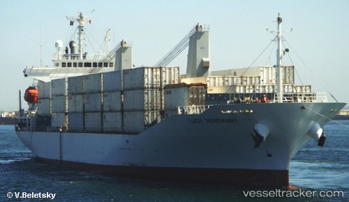
Vessel Lady Rosemary IMO: 9355044, MMSI: 357919000 Refrigerated Cargo Ship
UTC, 36.17662, -71.15652, course: 335, speed: 16.1
UTC, 36.51548, -71.43908, course: 300, speed: 15
2026-01-18 07:14:38 UTC, 36.54513, -71.49320, course: 307, speed: 15.2
Live AIS position:
UTC. 177 nm N of Ben Slimane),
updated 2026-01-18 07:14:38 UTC.
Find the position of the vessel Lady Rosemary on the map. The latter are known coordinates and path.
marine traffic ship tracker show on live map
The current position of vessel Lady Rosemary is 36.54513 lat / -71.49320 lng. Updated: 2026-01-18 07:14:38 UTCDetails:
Last coordinates of the vessel:
UTC, 35.98207, -71.06052, course: 336, speed: 17.4UTC, 36.17662, -71.15652, course: 335, speed: 16.1
UTC, 36.51548, -71.43908, course: 300, speed: 15
2026-01-18 07:14:38 UTC, 36.54513, -71.49320, course: 307, speed: 15.2