 vesseltracker.com
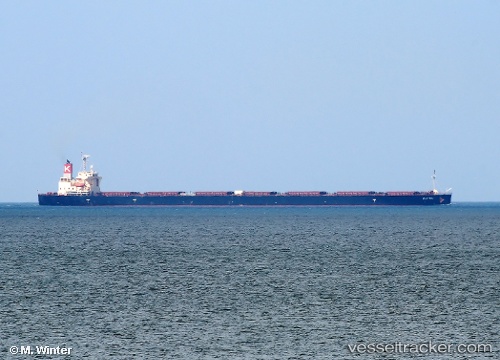
Vessel Elettra IMO: 9355496, MMSI: 371188000 Bulk Carrier
UTC, -19.67747, 148.08997, course: 103, speed: 0
UTC, -19.67762, 148.08989, course: 98, speed: 0
2026-01-18 16:37:56 UTC, -19.67755, 148.08995, course: 99, speed: 0
Live AIS position:
UTC. 13 nm N of Abbot Point),
updated 2026-01-18 16:37:56 UTC.
Find the position of the vessel Elettra on the map. The latter are known coordinates and path.
marine traffic ship tracker show on live map
The current position of vessel Elettra is -19.67755 lat / 148.08995 lng. Updated: 2026-01-18 16:37:56 UTCCurrently sailing under the flag of Panama
Elettra built in 2009 year
Deadweight:
106355 tDetails:
Last coordinates of the vessel:
UTC, -19.67761, 148.08990, course: 99, speed: 0UTC, -19.67747, 148.08997, course: 103, speed: 0
UTC, -19.67762, 148.08989, course: 98, speed: 0
2026-01-18 16:37:56 UTC, -19.67755, 148.08995, course: 99, speed: 0