 vesseltracker.com
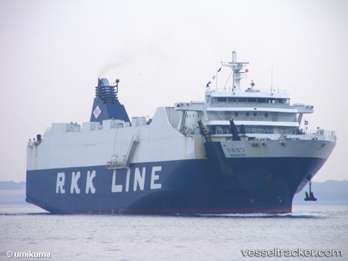
Vessel Wakanatsu IMO: 9360362, MMSI: 431680233 Ro Ro Cargo Ship
UTC, 26.23692, 127.67827, course: 182, speed: 0
UTC, 26.23703, 127.67830, course: 182, speed: 0
2026-01-16 10:08:16 UTC, 26.17918, 127.52432, course: 241, speed: 17.3
Live AIS position:
UTC. Near Tomigusuku, Okinawa),
updated 2026-01-16 10:08:16 UTC.
Find the position of the vessel Wakanatsu on the map. The latter are known coordinates and path.
marine traffic ship tracker show on live map
The current position of vessel Wakanatsu is 26.17918 lat / 127.52432 lng. Updated: 2026-01-16 10:08:16 UTCCurrently sailing under the flag of Japan
Wakanatsu built in 2006 year
Deadweight:
6890 tDetails:
Last coordinates of the vessel:
UTC, 26.23687, 127.67828, course: 182, speed: 0.1UTC, 26.23692, 127.67827, course: 182, speed: 0
UTC, 26.23703, 127.67830, course: 182, speed: 0
2026-01-16 10:08:16 UTC, 26.17918, 127.52432, course: 241, speed: 17.3