 vesseltracker.com
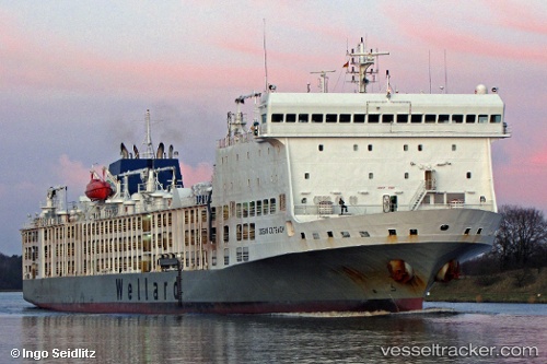
Vessel Bahijah IMO: 9360788, MMSI: 538007603 Livestock Carrier
UTC, 35.89041, 14.77380, course: 176, speed: 0.1
UTC, 35.89053, 14.77353, course: 175, speed: 0.2
2026-01-15 08:26:37 UTC, 35.89054, 14.77351, course: 176, speed: 0
Live AIS position:
UTC. 10 nm E of Il-Kappara),
updated 2026-01-15 08:26:37 UTC.
Find the position of the vessel Bahijah on the map. The latter are known coordinates and path.
marine traffic ship tracker show on live map
The current position of vessel Bahijah is 35.89054 lat / 14.77351 lng. Updated: 2026-01-15 08:26:37 UTCCurrently sailing under the flag of Marshall Is
Bahijah built in 2010 year
Deadweight:
7907 tDetails:
Last coordinates of the vessel:
UTC, 35.89022, 14.77422, course: 163, speed: 0.3UTC, 35.89041, 14.77380, course: 176, speed: 0.1
UTC, 35.89053, 14.77353, course: 175, speed: 0.2
2026-01-15 08:26:37 UTC, 35.89054, 14.77351, course: 176, speed: 0