 vesseltracker.com
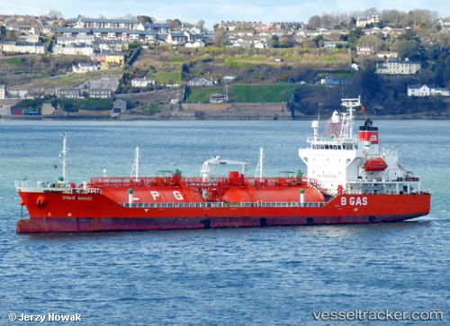
Vessel B Gas Maud IMO: 9363522, MMSI: 248102000 Lpg Tanker
UTC, 55.37500, 12.68492, course: 9, speed: 11.8
UTC, 55.65130, 12.94993, course: 334, speed: 11.4
2026-02-07 08:29:05 UTC, 56.09060, 12.59392, course: 313, speed: 13.3
Live AIS position:
UTC. Near Ålsgårde),
updated 2026-02-07 08:29:05 UTC.
Find the position of the vessel B Gas Maud on the map. The latter are known coordinates and path.
marine traffic ship tracker show on live map
The current position of vessel B Gas Maud is 56.09060 lat / 12.59392 lng. Updated: 2026-02-07 08:29:05 UTCCurrently sailing under the flag of Malta
B Gas Maud built in 2006 year
Deadweight:
5073 tDetails:
Last coordinates of the vessel:
UTC, 55.14003, 13.33003, course: 290, speed: 12.2UTC, 55.37500, 12.68492, course: 9, speed: 11.8
UTC, 55.65130, 12.94993, course: 334, speed: 11.4
2026-02-07 08:29:05 UTC, 56.09060, 12.59392, course: 313, speed: 13.3