 vesseltracker.com
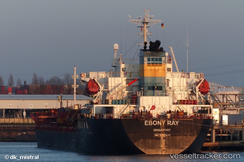
Vessel Ebony Ray IMO: 9363857, MMSI: 563136000 Chemical Oil Products Tanker
UTC, 15.86833, 115.65667, course: -1, speed: 11
UTC, 15.78158, 115.48109, course: 210, speed: 11.9
2026-01-17 18:08:41 UTC, 15.39833, 115.23833, course: -1, speed: 11
Live AIS position:
UTC. 274 nm W of Iba),
updated 2026-01-17 18:08:41 UTC.
Find the position of the vessel Ebony Ray on the map. The latter are known coordinates and path.
marine traffic ship tracker show on live map
The current position of vessel Ebony Ray is 15.39833 lat / 115.23833 lng. Updated: 2026-01-17 18:08:41 UTCCurrently sailing under the flag of Singapore
Ebony Ray built in 2008 year
Deadweight:
19998 tDetails:
Last coordinates of the vessel:
UTC, 15.93833, 115.73333, course: -1, speed: 12UTC, 15.86833, 115.65667, course: -1, speed: 11
UTC, 15.78158, 115.48109, course: 210, speed: 11.9
2026-01-17 18:08:41 UTC, 15.39833, 115.23833, course: -1, speed: 11