 vesseltracker.com
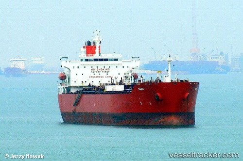
Vessel KASHI IMO: 9374337, MMSI: 419001875 Chemical/Oil Products Tanker
UTC, 22.81567, 41.24633, course: 15, speed: 38.8
UTC, 22.87943, 41.32828, course: 356, speed: 38.9
2026-01-18 22:59:33 UTC, 23.25924, 41.81747, course: 352, speed: 38.8
Live AIS position:
UTC. 157 nm E of King Abdullah),
updated 2026-01-18 22:59:33 UTC.
Find the position of the vessel KASHI on the map. The latter are known coordinates and path.
marine traffic ship tracker show on live map
The current position of vessel KASHI is 23.25924 lat / 41.81747 lng. Updated: 2026-01-18 22:59:33 UTCCurrently sailing under the flag of India
KASHI built in 2006 year
Deadweight:
46159 tDetails:
Last coordinates of the vessel:
UTC, 22.24242, 40.50385, course: 32, speed: 38.5UTC, 22.81567, 41.24633, course: 15, speed: 38.8
UTC, 22.87943, 41.32828, course: 356, speed: 38.9
2026-01-18 22:59:33 UTC, 23.25924, 41.81747, course: 352, speed: 38.8