 vesseltracker.com
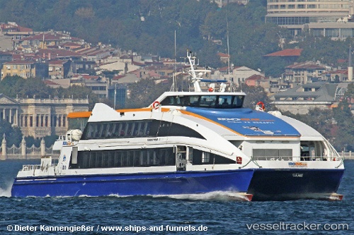
Find the position of the vessel Murat Reis 7 on the map. The latter are known coordinates and path.
marine traffic ship tracker show on live map
The current position of vessel Murat Reis 7 is 40.9467 lat / 29.0857 lng. Updated: 2025-07-05 16:17:02 UTCCurrently sailing under the flag of Turkey
Murat Reis 7 built in 2007 year
Port of registry:
Istanbul (city in Turkey located at the Bosporus Strait)Deadweight:
50 tPayload_mass:
50 tonneGross tonnage:
644Service entry:
2007-01-01T00:00:00ZDetails:
Last coordinates of the vessel:
UTC, 40.6889, 27.972, course: -1, speed: 24.6UTC, 40.8275, 28.3619, course: -1, speed: 24.7
UTC, 40.9707, 28.718, course: -1, speed: 0
2025-07-05 16:17:02 UTC, 40.9467, 29.0857, course: -1, speed: 25.1