 vesseltracker.com
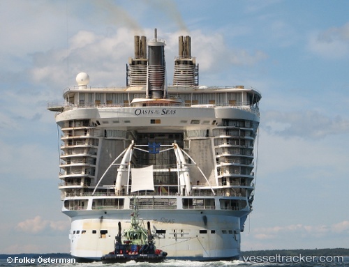
Vessel Oasis Of The Seas IMO: 9383936, MMSI: 311020600 Cruise Ship
UTC, 21.78333, -76.70500, course: -1, speed: 18
UTC, 22.21470, -77.50383, course: 315, speed: 15.3
2026-02-06 16:07:08 UTC, 22.46666, -77.86333, course: -1, speed: 15
Live AIS position:
UTC. 35 nm E of Cayo Coco),
updated 2026-02-06 16:07:08 UTC.
Find the position of the vessel Oasis Of The Seas on the map. The latter are known coordinates and path.
marine traffic ship tracker show on live map
The current position of vessel Oasis Of The Seas is 22.46666 lat / -77.86333 lng. Updated: 2026-02-06 16:07:08 UTCDetails:
Last coordinates of the vessel:
UTC, 21.65333, -76.35667, course: -1, speed: 17UTC, 21.78333, -76.70500, course: -1, speed: 18
UTC, 22.21470, -77.50383, course: 315, speed: 15.3
2026-02-06 16:07:08 UTC, 22.46666, -77.86333, course: -1, speed: 15