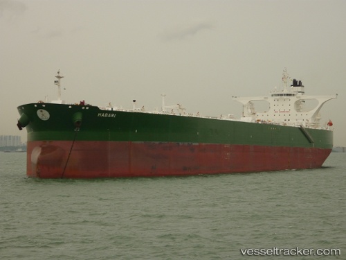
vessel 'HABARI' IMO: 9386940, vesseltracker.com
Vessel 'HABARI' IMO: 9386940,
MMSI: 403590001 callsign: size: x

Find the position of the vessel 'HABARI' on the map. The latter are known coordinates and path.

marine traffic ship tracker show on live map

The current position of vessel 'HABARI' is 24.0684 lat / 37.5703 lng. Updated: 2025-07-01 03:25:35 UTC
Port of registry:
Nassau (capital and largest city of the Bahamas)
Gross tonnage:
160782
Service entry:
2008-01-01T00:00:00Z

Manufacturer:
HD Hyundai Samho (Korean shipbuilding company)
Details:


Last coordinates of the vessel:
UTC, 24.0947, 37.561, course: 218, speed: 0.9
UTC, 24.0792, 37.5682, course: 270, speed: 0.6
UTC, 24.0715, 37.5696, course: 296, speed: 0.4
2025-07-01 03:25:35 UTC, 24.0684, 37.5703, course: 292, speed: 0.3

The ship also appears on the maps:


Most frequent ports a vessels calls at 'HABARI' (403590001):

Chimu Wan, traffic: 2
Loop Terminal, traffic: 1
Ra’S Shukhayr, traffic: 1
Sambu, traffic: 1
Singapore, traffic: 1
Ayn Sukhnah, traffic: 1

Link to the map:


Find another ship

'HABARI' (403590001) last ports (portcalls and passsages)

Ayn Sukhnah | 2024-01-09 20:15:09
Ra’S Shukhayr | 2024-01-09 11:30:50
Chimu Wan | 2022-09-20 22:36:54
Chimu Wan | 2022-09-14 01:32:56
Sambu | 2022-09-06 22:55:33
Loop Terminal | 2022-01-25 02:25:33