 vesseltracker.com
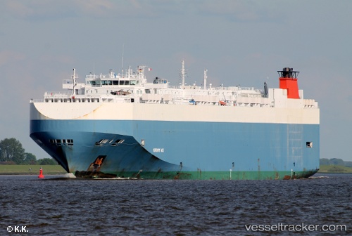
Vessel Serenity Ace IMO: 9391579, MMSI: 311002800 Vehicles Carrier
UTC, 24.25290, 159.22942, course: 288, speed: 12.1
UTC, 24.38167, 158.81667, course: -1, speed: 12
2026-01-20 06:10:02 UTC, 24.55634, 158.26408, course: 291, speed: 11.6
Live AIS position:
UTC. Open sea (no nearby ports in database)),
updated 2026-01-20 06:10:02 UTC.
Find the position of the vessel Serenity Ace on the map. The latter are known coordinates and path.
marine traffic ship tracker show on live map
The current position of vessel Serenity Ace is 24.55634 lat / 158.26408 lng. Updated: 2026-01-20 06:10:02 UTCCurrently sailing under the flag of Bahamas
Serenity Ace built in 2008 year
Deadweight:
21004 tDetails:
Last coordinates of the vessel:
UTC, 24.16500, 159.49333, course: -1, speed: 12UTC, 24.25290, 159.22942, course: 288, speed: 12.1
UTC, 24.38167, 158.81667, course: -1, speed: 12
2026-01-20 06:10:02 UTC, 24.55634, 158.26408, course: 291, speed: 11.6