 vesseltracker.com
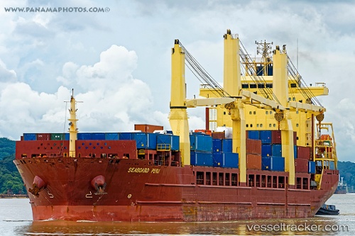
Vessel Seaboard Peru IMO: 9393577, MMSI: 212287000 Multi Purpose Carrier
UTC, -14.85529, 1.80381, course: 324, speed: 13.1
UTC, -14.76333, 1.73167, course: -1, speed: 13
2026-01-18 11:55:21 UTC, -14.47167, 1.50500, course: -1, speed: 13
Live AIS position:
UTC. Open sea (no nearby ports in database)),
updated 2026-01-18 11:55:21 UTC.
Find the position of the vessel Seaboard Peru on the map. The latter are known coordinates and path.
marine traffic ship tracker show on live map
The current position of vessel Seaboard Peru is -14.47167 lat / 1.50500 lng. Updated: 2026-01-18 11:55:21 UTCCurrently sailing under the flag of Cyprus
Seaboard Peru built in 2010 year
Deadweight:
25774 tDetails:
Last coordinates of the vessel:
UTC, -14.98589, 1.90663, course: 324, speed: 13.2UTC, -14.85529, 1.80381, course: 324, speed: 13.1
UTC, -14.76333, 1.73167, course: -1, speed: 13
2026-01-18 11:55:21 UTC, -14.47167, 1.50500, course: -1, speed: 13