 vesseltracker.com
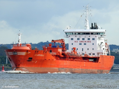
Vessel Stavfjord IMO: 9401544, MMSI: 259888000 Chemical Oil Products Tanker
UTC, 51.36042, 3.76946, course: 116, speed: 10.9
UTC, 51.42268, 4.02711, course: 157, speed: 9.9
2026-01-16 15:55:00 UTC, 51.37302, 4.13662, course: 70, speed: 10.7
Live AIS position:
UTC. Near PAAL),
updated 2026-01-16 15:55:00 UTC.
Find the position of the vessel Stavfjord on the map. The latter are known coordinates and path.
marine traffic ship tracker show on live map
The current position of vessel Stavfjord is 51.37302 lat / 4.13662 lng. Updated: 2026-01-16 15:55:00 UTCCurrently sailing under the flag of Norway
Stavfjord built in 2009 year
Deadweight:
16635 tDetails:
Last coordinates of the vessel:
UTC, 51.44026, 3.66069, course: 101, speed: 10.9UTC, 51.36042, 3.76946, course: 116, speed: 10.9
UTC, 51.42268, 4.02711, course: 157, speed: 9.9
2026-01-16 15:55:00 UTC, 51.37302, 4.13662, course: 70, speed: 10.7