 vesseltracker.com
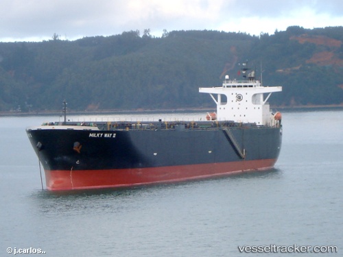
Vessel Milky Way Ii IMO: 9405447, MMSI: 370412000 Wood Chips Carrier
UTC, 20.53412, 111.85318, course: 251, speed: 12.3
UTC, 20.48502, 111.69485, course: 258, speed: 12.1
2026-01-16 23:40:18 UTC, 20.40148, 111.45838, course: 247, speed: 11.8
Live AIS position:
UTC. 52 nm NE of Honghai),
updated 2026-01-16 23:40:18 UTC.
Find the position of the vessel Milky Way Ii on the map. The latter are known coordinates and path.
marine traffic ship tracker show on live map
The current position of vessel Milky Way Ii is 20.40148 lat / 111.45838 lng. Updated: 2026-01-16 23:40:18 UTCDetails:
Last coordinates of the vessel:
UTC, 20.62330, 112.10665, course: 252, speed: 12UTC, 20.53412, 111.85318, course: 251, speed: 12.3
UTC, 20.48502, 111.69485, course: 258, speed: 12.1
2026-01-16 23:40:18 UTC, 20.40148, 111.45838, course: 247, speed: 11.8